Our Work
Helping communities respond
Coastal flooding and erosion pose a serious threat to people and infrastructure on Arctic coastlines, but there is a disconnect between the education of Alaska Native stakeholders and the research and policy strategies that impact their futures. This has resulted in Alaska Natives being underrepresented in science fields and being at a disadvantage when making decisions regarding their community’s response to storm hazards. This research aims to advance knowledge regarding contemporary, historical, and paleo-storm impacts in western Alaska while supporting informed decision-making and increased research capacity in the Arctic. The Arctic Coastal Geoscience Lab will employ an innovative strategy that integrates research and education activities to increase the understanding of storm-related coastal sediment dynamics and its relationship to sea ice conditions. The research will be coupled with a field- and lab-based education plan focused on building coastal science literacy to support informed decision-making.
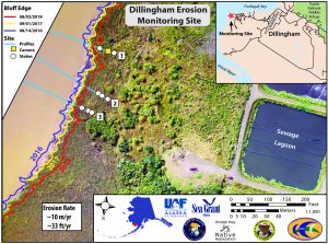
Community-based monitoring
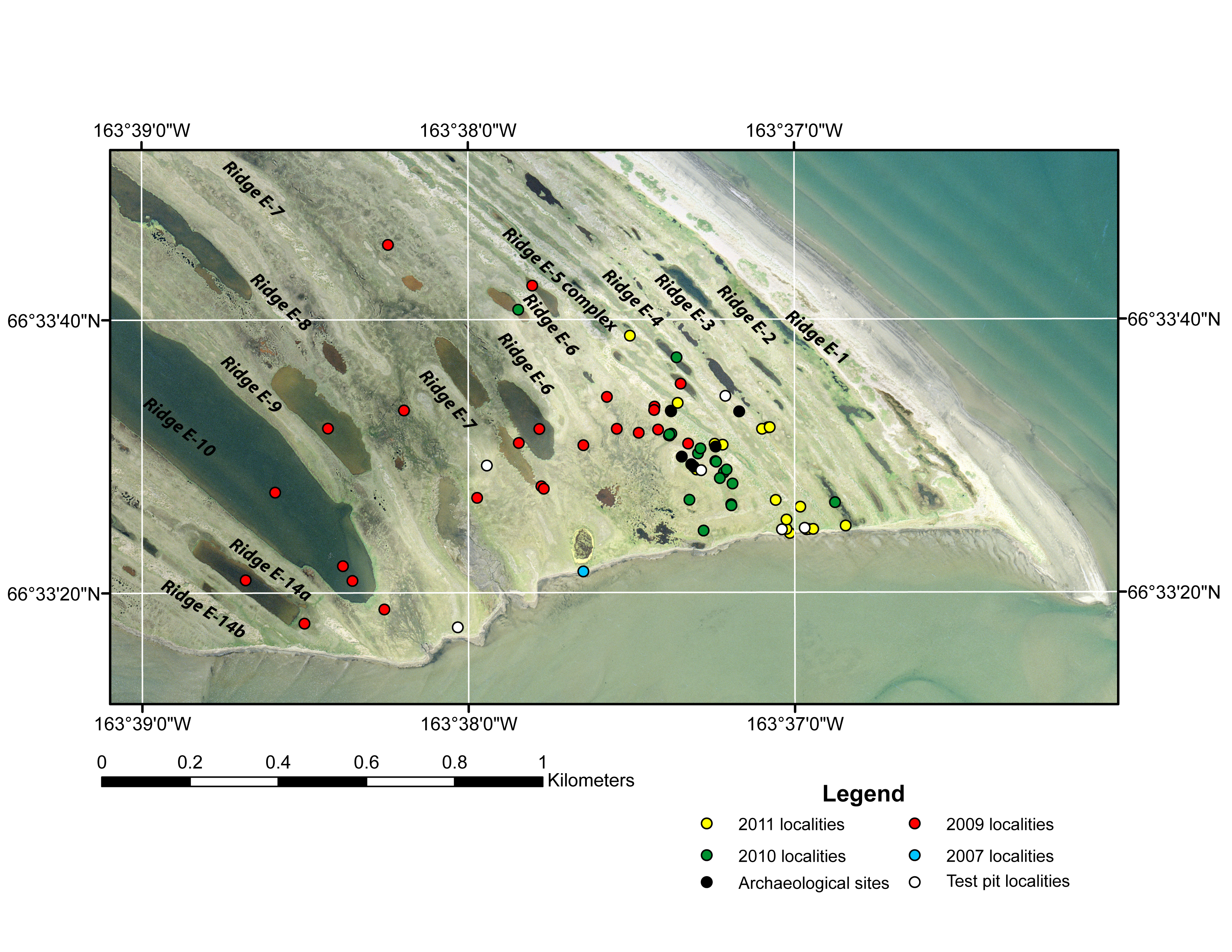
Alaska’s western coastline is one of the most understudied regions in the United States and its location is highly vulnerable to current and future climate change. A collaboration between the ACGL and the Alaska Division of Geological and Geophysical Surveys Coastal Hazard Program serves more than 20 Alaska coastal villages to create new baseline datasets, assess coastal hazards and risks, and establish and maintain erosion monitoring sites. A close working relationship with local and regional stakeholders guides the research.
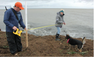
Collaborative research identifies coastal hazards and provides actionable adaptation and mitigation strategies to the Native Village of Port Heiden. Project partners include the Native Village of Port Heiden, Alaska Sea Grant, Alaska Native Tribal Health Consortium, Alaska Division of Geological and Geophysical Surveys, Bristol Bay Native Association, NOAA-NOS-NGS, and the Environmental Protection Agency.
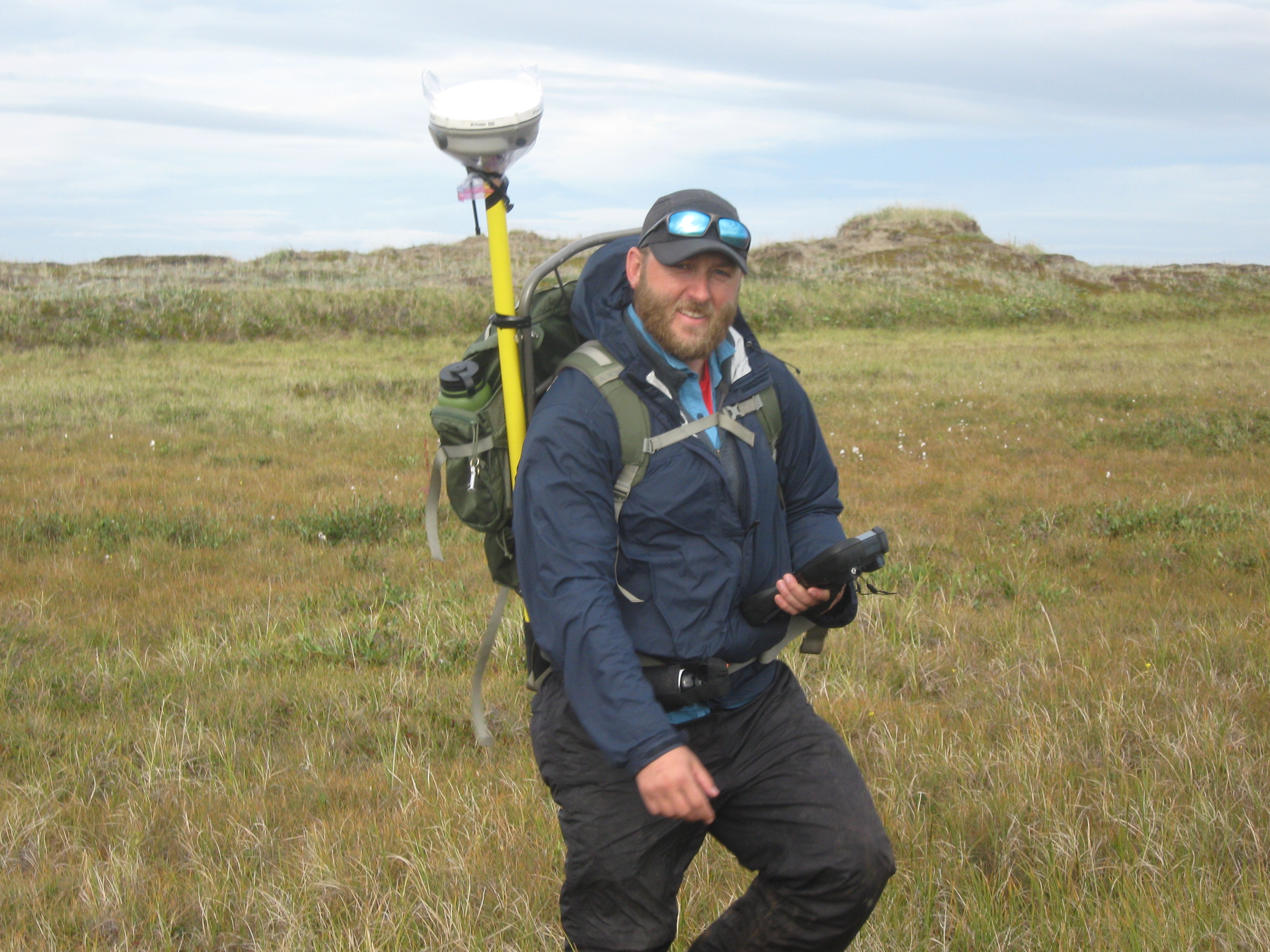
Local environmental coordinator Scott Anderson assists with GPS survey. Video documenting coastal erosion in Port Heiden, Alaska. The rate of coastal erosion here is one of the highest in the world. Filmed by Mike Brubaker, May 2017.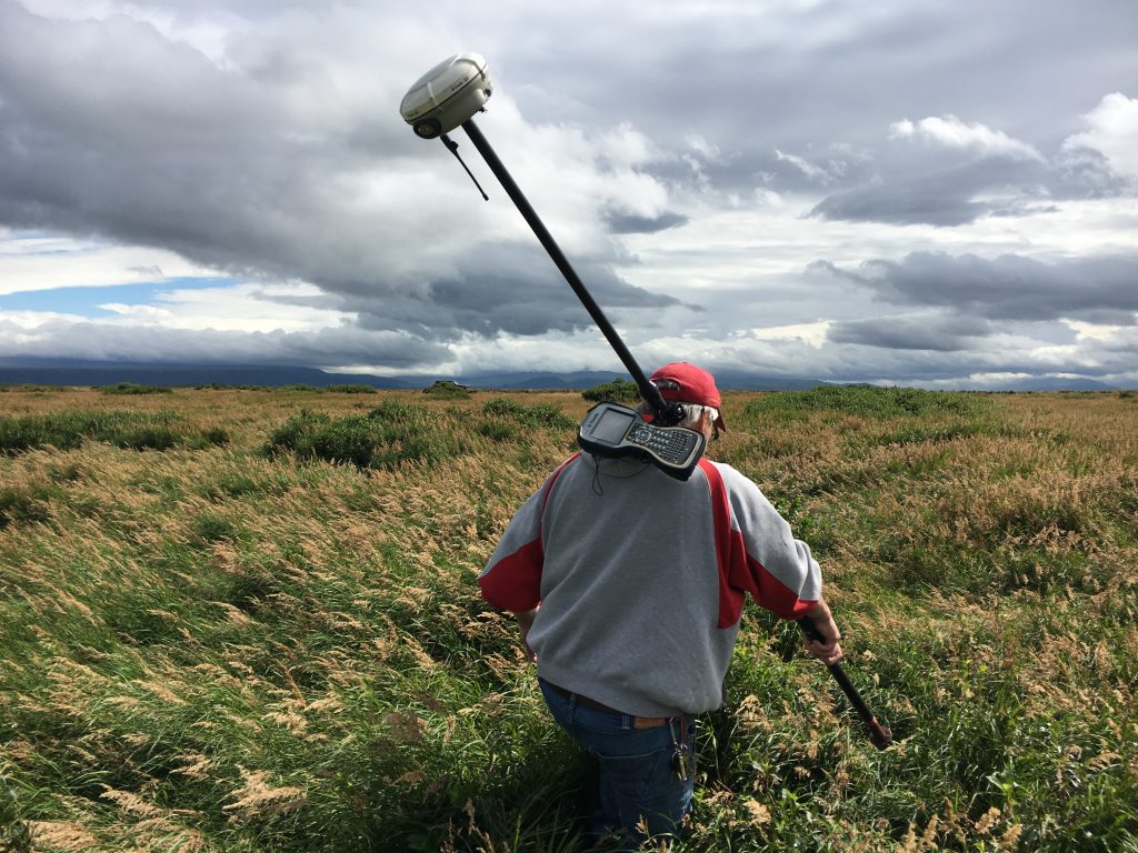
Paleotempestology
Storm-driven flooding poses one of the greatest threats to coastal Alaska communities and natural resources, yet researchers lack data about the long-term frequency and return interval of major storms. This is partially due to the remoteness and harsh environmental conditions encountered in these regions. Paleotempestology, the study of prehistoric storms based on geologic proxies, can help address the lack of data.
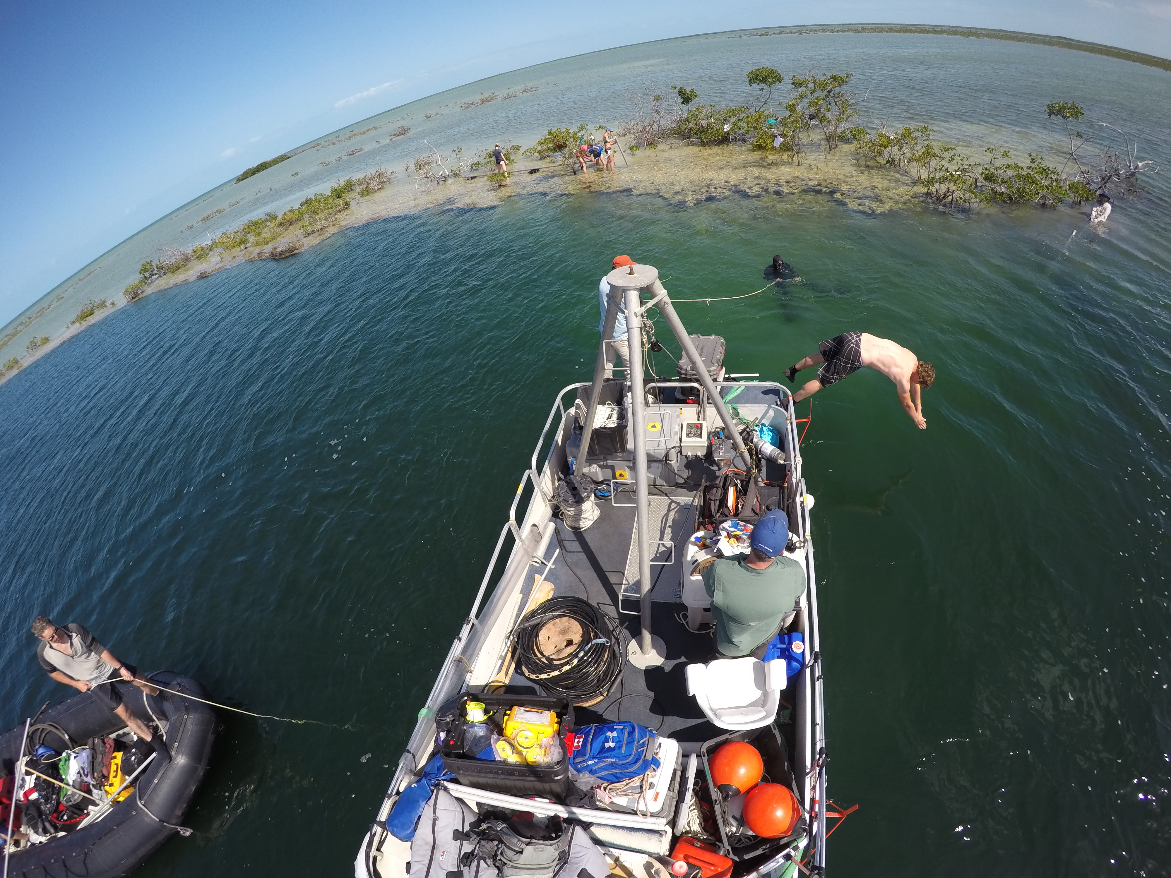
RESEARCH AT TURTLE POND BLUE HOLE

Geospatial analysis
- Shoreline change analysis
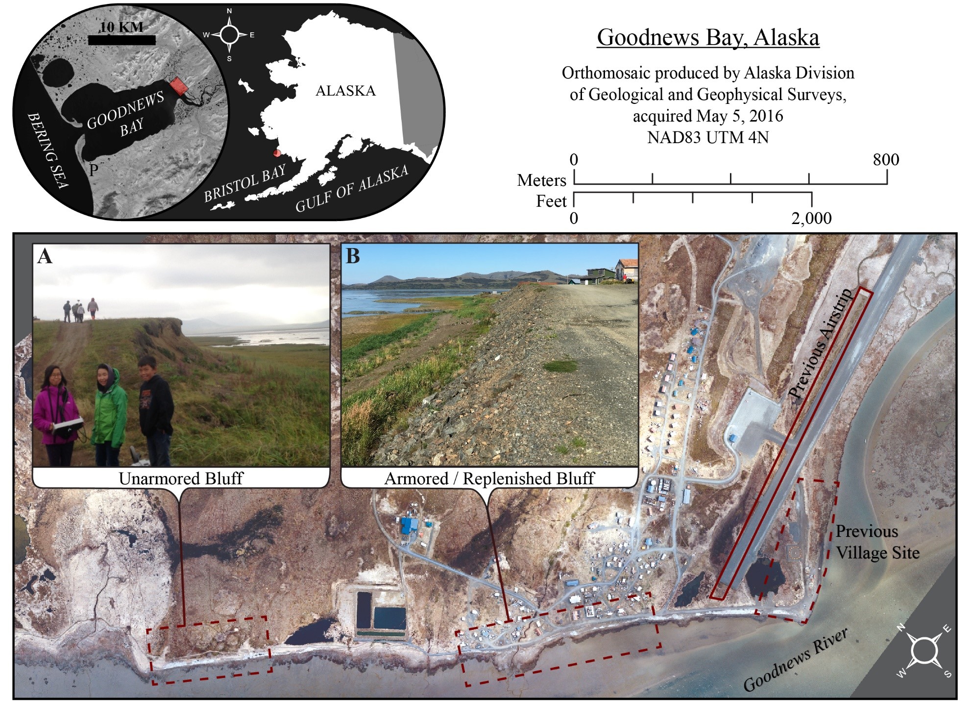
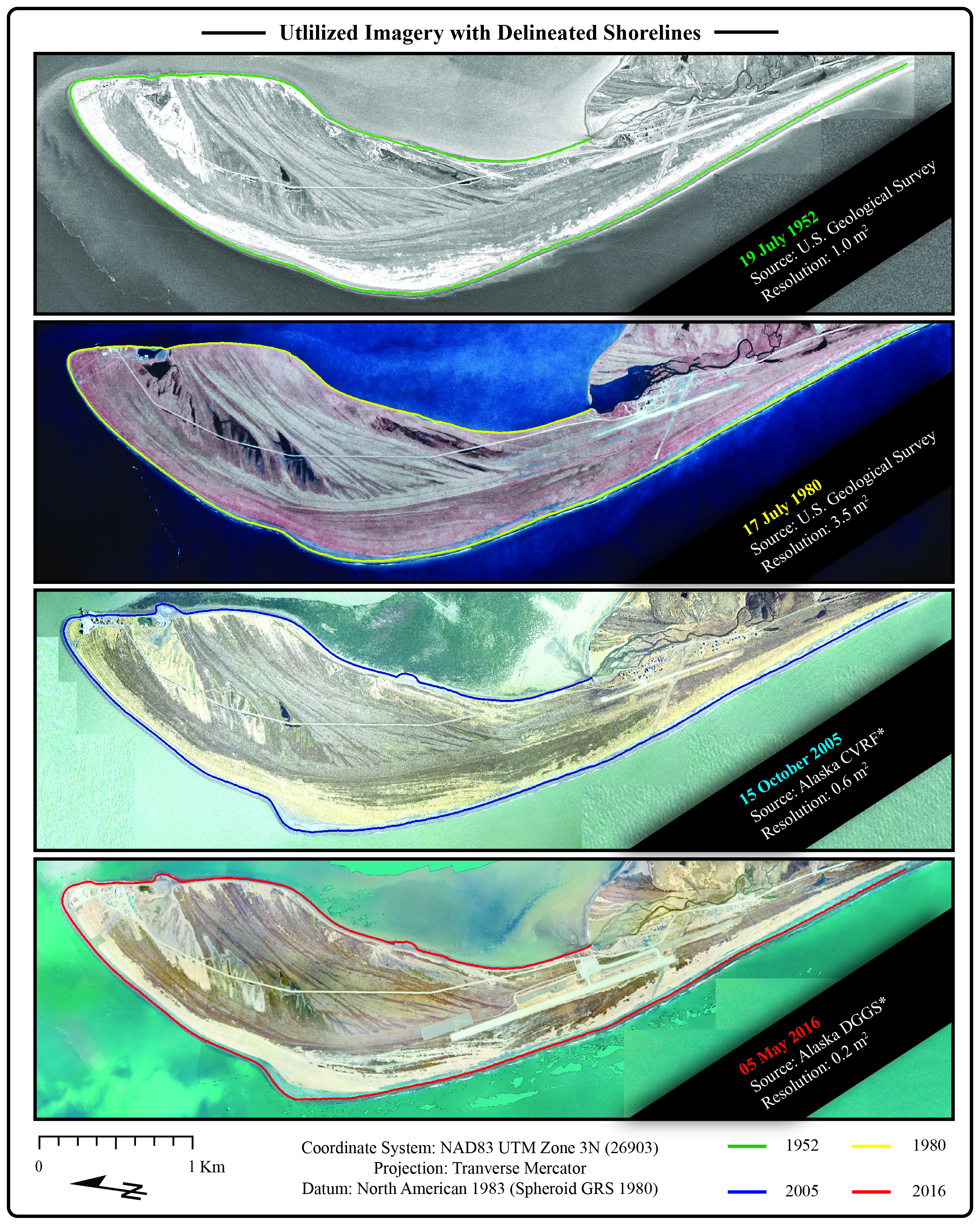
Consistent documentation of shoreline change in communities that are subject to coastal or riverine erosion is a critical foundation for understanding both episodic and long-term changes that impact public health, safety and well-being. This is also a necessary step toward estimating long-term erosion rates and making informed decisions about development and the relocation of at-risk infrastructure. GIS-based shoreline change analysis uses the USGS Digital Shoreline Analysis System to help calculate historical shoreline trends and identify areas of erosion and accretion.
Alaska Sea Grant funded research focused on assessing the coastal resiliency of Goodnews Bay, Alaska. The project included the development of baseline high resolution topographical data, a shoreline change analysis, and a community outreach program.

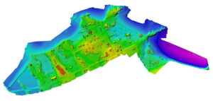
- Structure from motion
Structure-from-motion software is a photogrammetric technique that produces 3D imagery from 2D images. This software and aerial imagery allow the development of low-cost, high-accuracy photographs and elevation datasets.